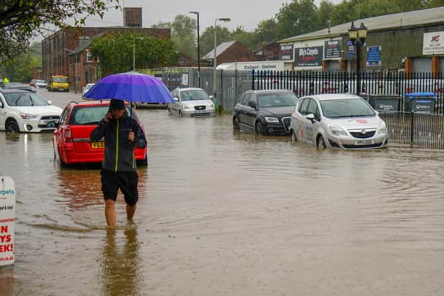
Updated: Flood alerts issued across Derbyshire as flooding is possible


As the water levels remain high following heavy rainfall, there are currently 14 flood alerts in place across Derbyshire, meaning that flooding is possible.
River levels are high but steady at Ashford in the Water river gauge as a result of heavy rainfall. Consequently, the risk of flooding remains. Areas most at risk are low-lying agricultural land and roads including Ashford and Bakewell areas. It is expected that river levels to remain high throughout today. Further heavy rainfall is forecast over the next 24 hours.
Advertisement
Hide AdAdvertisement
Hide AdAt Lower Derwent, water levels remain high at the Church Wilne river gauge as a result of heavy rainfall. Areas most at risk are low-lying agricultural land and roads including Church Wilne, Draycott, and Wilne Lane between Draycott and Sawle.
River levels have risen at the Marston-on-Dove river gauge as a result of persistent rainfall yesterday. Flooding is affecting low-lying land and roads adjacent to the River Dove between Rocester and Clay Mills.
With water levels remaining high at the Pillings Lock river gauge, flooding of roads and farmland is possible. Areas most at risk are low-lying agricultural land and roads including Slash Lane at Sileby and the Mountsorrel to Sileby road.
River levels have risen at the Hopwas Bridge river gauge. Flooding is affecting low-lying land and roads adjacent to the River Tame between Hopwas and the National Arborteum at Alrewas.
Advertisement
Hide AdAdvertisement
Hide AdRiver levels remain high but are beginning to fall at the Mancetter river gauge. Consequently, the risk of flooding is reducing. Flooding is affecting low-lying land and roads adjacent to the River Anker between Nuneaton and Tamworth the River Sence between Temple Mill and Ratcliffe Culey.
River levels remain high but steady at the Hamstall Ridware river. Consequently, the risk of flooding remains. Flooding is affecting low-lying land and roads adjacent to the River Blithe between Blythe Bridge and Nethertown and on the River Swarbourne between Hoar Cross and Yoxall.
The water level is still high at the Whitewater Bridge river. Areas most at risk are low-lying agricultural land and roads around Mansfield, the Sherwood Forest Caravan Park at Clipstone, Edwinstowe, Ollerton, Whitewater Lane at Whitewater Bridge and West Drayton.
River levels are rising at the Milford river. Flooding is affecting low-lying land and roads adjacent to the River Sow between Great Bridgeford and Shugborough, the River Penk between Coven and Stafford, the Sandyford Brook, the Rising Brook, the Ridings Brook and the Saredon Brook.
Advertisement
Hide AdAdvertisement
Hide AdRiver levels are high but steady at the Willington and Shardlow gauges as a result of heavy rainfall. Consequently, the risk of flooding remains. Areas most at risk are low-lying agricultural land and roads including Willington, Barrow upon Trent, Swarkestone, Bargate Lane and the access roads to Willington Meadows, the Twyford Village access road, Church Lane at Barrow, and Ingleby Lane. It is expected that river levels will remain high until at least tomorrow, December 30. Further heavy rainfall is forecast over the next 24 hours.
River levels are high but steady at the Colwick river gauge as a result of heavy rainfall. Consequently, the risk of flooding remains. Areas most at risk are low-lying agricultural land and roads including communities near to the River Trent, the Queens Drive Park and Ride and Stoke Lane at Stoke Bardolph, the Caythorpe to Hoveringham, and cellars of low-lying properties at Cavendish Bridge.
Residents of the areas affected are urged to avoid using low-lying footpaths near local watercourses and plan driving routes to avoid low-lying roads near rivers, which may be flooded.
Comment Guidelines
National World encourages reader discussion on our stories. User feedback, insights and back-and-forth exchanges add a rich layer of context to reporting. Please review our Community Guidelines before commenting.