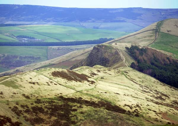
Walk this Way, Peak District


Details:
TIME: 3¾ hours
DISTANCE: 7½ miles
TERRAIN: mixed
ABILITY: able
PARKING: yes
DETAILS: Hope Valley is one of the most attractive areas of the Peak and contains an unrivalled mixture of scenery, with limestone crags and dales on one side and the shale hills of Mam Tor, Lose Hill and Win Hill on the other.
This circuit takes you around the head of the valley to sample some of the highlights.
WHERE TO MEET: In the centre of Castleton
HOW TO GET THERE: Peak district Information
ROUTE:
Advertisement
Hide AdAdvertisement
Hide Ad1: Start in the centre of Castleton and walk up past the church into the main square behind. Take the narrow road out of the south-west corner of the square, which leads to Peak Cavern, but after crossing Peakshole water continue past the cavern entrance and along to the end of Goosehill - which was once the main route up to Peveril Castle.
2: Winnats Pass: Beyond the end of the tarmac a green track runs around the foot of the hillside to Speedwell Cavern entrance and the road down Winnats Pass. From here you are aiming for Mam Tor, but there is a choice of routes. If you want to see Winnats, which is very impressive, then walk up the gorge and then take the path which leads behind Winnats Head Farm to Windy Knoll and Mam Nick (the gap between Mam Tor and Rushup Edge).This route is direct and spectacular but often noisy with traffic.
3: Mam Tor from Odin Mine workings: Alternatively, cross the Winnats Pass road when you reach it below Speedwell Cavern and continue to Treak Cliff Cavern. Above the cavern entrance a path continues, climbing up and around the hillside to the Blue John Cavern and offering splendid views across the Hope Valley. From Blue John walk up the old road, closed by a landslip in 1971, and then branch off right across the fields and past the spoil heaps which surround the site of a mineshaft from the Odin Mine to arrive at the carpark below Mam Nick. This is more relaxed and has better situations.
4: Mam Tor Iron Age ramparts and Edale: From Mam Nick a well-made path leads up to the summit of Mam Tor, passing the line of the Iron Age fortifications about half-way up. The summit is actually capped by a Bronze Age burial tumulus, but this has a trig point on top and has been so severely eroded by visitors’ feet that you wouldn’t guess it was there. The whole summit area has recently been paved by the National Trust, who own the hill.
Advertisement
Hide AdAdvertisement
Hide Ad5: Mam Tor is a magnificent viewpoint with a panoramic view of the Hope Valley and an equally fine one over Edale to Kinder Scout. It’s also one of the easiest viewpoints to reach, so it can be a crowded spot in summer. Because it seems to collect the wind from all quarters it is popular with hang-gliding enthusiasts and if the wind is from the east you will probably find hang-gliders and paragliders taking off from the summit area, jumping straight off the cliff - pretty impressive stuff.
6: Back Tor: The return route to Castleton takes you along the ridge which separates the Hope Valley from Edale and after the long climb up from Castleton it is welcome to find that this is downhill almost all the way, so you can relax and enjoy the scenery. The well-trodden path leaves the summit area via the old entrance to the fort and continues easily down to Hollins Cross, from where a badly eroded path leads straight back to Castleton. However the ridge continues and if you have the energy then it is well worth continuing right along, over Back Tor to Lose Hill, so named because the losing Northumbrians camped here after a battle with the Mercians in the 8th century. (And the winners camped on Win Hill, obviously!)
7: From the summit of Lose Hill a wide path descends to Hope. Go down it for 300 metres to a large pile of stones and there cross the fence on your right to follow a path which descends to Crimea Farm (Losehill Farm on the map). Go around the farm and down the track which leads up to it. At the next farm, Spring House, turn right and walk behind Losehill Hall and continue in the same direction across fields and a small stream to reach the track which leads back into Castleton.