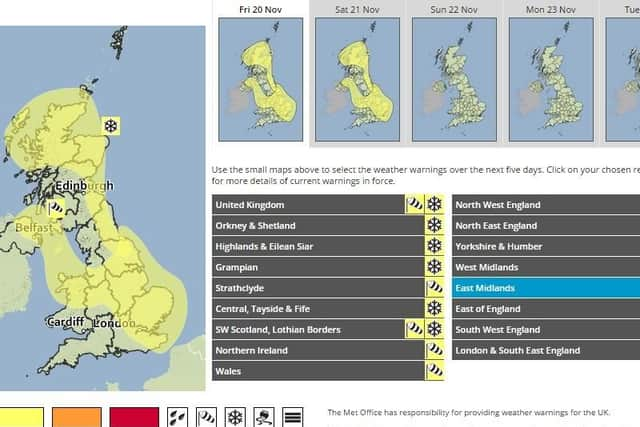
WEATHER WARNING: Wintry gales bring snow and ice


A swathe of gale force winds and a band of rain and snow, will move south across much of central and southern Britain tonight and tomorrow.
Some of the snow may settle, likely over high ground but also the chance at low levels, with wind gusts of 50-60 mph most likely but possibly 60-70 mph.
Advertisement
Hide AdAdvertisement
Hide AdThe Met Office said: "The worst affected areas may see a few cm but on current evidence, most places will see little if any lying snow. On Saturday morning, ice will be an additional hazard, particularly for higher level routes. Please be aware of the likelihood of some difficult driving conditions and possible travel disruption."
The weather is caused by a temporary chance in the winds, bringing much colder air across the whole of Britain and western Europe, after what has been an exceptionally mild first half of November.
Wintry showers will develop during the day after a mainly dry and sunny start, and increasingly cold air over the Derbyshire hills will see temperatures of around seven degrees, and zero degrees centigrade this evening.
Into tomorrow there will be some sunny spells and occasional wintry showers, with strong and bitterly cold winds.